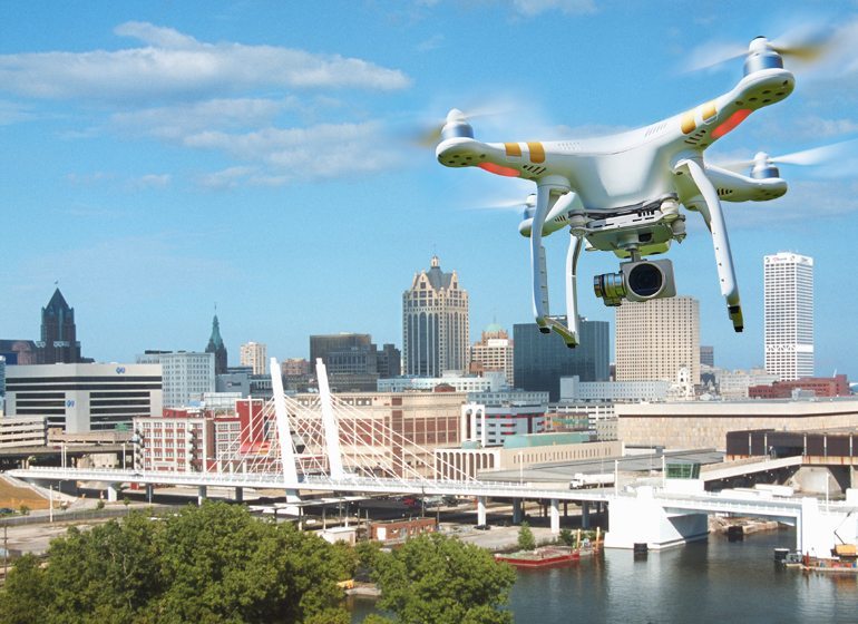
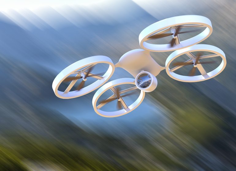
In just a few short years, drones have gone from a part of the War on Terror to a consumer technology with the potential to disrupt a host of industries.
Perhaps the most high profile potential disruption is Amazon’s desire to offer 30-minute delivery for online orders, but there are plenty of other examples. Real estate agents can use them to provide clients with perspective on properties. Insurance agencies can use them to survey the damage after a claim, particularly after catastrophic events when an area may not be safe for people. Land surveyors and construction firms can use drones to map jobsites or inspect structures. Farmers can spot troubled areas in their crops and deliver targeted treatment.
Plenty of entrepreneurs have seen the potential to create businesses out of drones, but the current Federal Aviation Administration regulations governing commercial uses limit what is possible, according to those with experience in the industry.
“Right now, the restriction that’s keeping most of the business uses under wraps is line of sight,” said Russ Klingaman, referring to an FAA restriction that requires commercial users to keep an eye on their drone while it’s in the air.
Klingaman, a partner at Hinshaw & Culbertson LLP in Milwaukee, teaches an aviation law class every other year as an adjunct at Marquette University Law School. When he started teaching in 2007, there wasn’t any mention of drones. In 2009, the class considered some of the implications of drone warfare. It wasn’t until 2015, though, that drones became a mainstay in classroom discussion.
“We probably talked about drones for 15 or 20 minutes every time we’d meet,” Klingaman said.
As interest in drones among hobbyists has exploded, so too has the level of interest in potential commercial activities. A 2013 forecast by the Association for Unmanned Vehicle Systems International estimated the drone industry would create more than 100,000 jobs and have $82 billion worth of economic impact in the United States between 2015 and 2025. That included $527 million and 665 jobs in Wisconsin.
The caveat was that the FAA needed to develop new regulations to integrate drones into the national airspace, with the authors calling it “perhaps the single most important aspect.”
Current FAA limitations on commercial drone use include:
- The drone must be operated by someone with at least a sport pilot license.
- Cannot go more than 87 knots or 100 miles per hour.
- Cannot go more than 400 feet above ground level.
- Must be operated within visual line of sight of the pilot, unaided by anything but corrective lenses.
- Must use a visual observer.
- Cannot fly at night.
- Cannot operate within five miles of an airport.
- Cannot be operated from a moving device or vehicle.
- Must remain at least 500 feet from all nonparticipating people, vehicles or structures, unless there is protection in place or the person had granted permission.
The FAA was supposed to have implemented a plan to integrate drones, also known as unmanned aerial systems (UAS) or unmanned aerial vehicles (UAV) into the national airspace system by Sept. 30, 2015. There are regulations in the works and a framework has emerged through an exemption process, but the actual deadline has passed without full integration.

“The UAS technology still has a long way to go until it’s commercially viable,” said Peter Menet, founder of Milwaukee-based drone services firm Menet Aero Inc. He said the industry could be five to 10 years from fully integrating into the national airspace.
Menet said the use of drones in business settings has been presented as if an employer could pick up a drone at Best Buy on the way home from work, hand it over to employees the next day and see cost savings and productivity improvement by the end of the week.
“The one thing you have to understand about the UAS industry is it’s really kind of overhyped,” Menet said.
It isn’t that drones aren’t already capable of performing a lot of tasks—Menet can collect high resolution data on 25 acres in just more than 15 minutes—but the regulatory environment limits what is possible and legal to do.
“You have to go into using a UAV with a very specific application or basically a knowledge of what you’re going to get back,” said Zach Fiene, a co-founder of Prairie du Sac-based DMZ Aerial.

Larry Harvey, marketing and communications manager at Menomonee Falls-based Tailored Label Products Inc., uses his drone for internal marketing purposes and shoots video inside. That use changes which regulations apply. He considers himself part hobbyist and part business user.
“I think a business user has to go out and educate themselves about what is legal to do,” Harvey said.
The drone gives him a unique view of the factory floor—one he wouldn’t be able to otherwise achieve without hiring a film crew. The drone also serves as a great display item for how labels are used when school tours visit, Harvey said.
He noted that a lot has changed in the drone industry since he first took an interest in it five or six years ago. The first drone he purchased could barely go 10 feet off the ground and was more a toy than anything else.
Today, drones have features such as built-in takeoff and landing technology, GPS navigation and collision detection capabilities. Amazon sells thousands of drone-related products and has a special section dedicated to drone photography. Prices for the DJI Phantom drone series —one of the most popular—range from about $300 to $1,400. Others reach $3,000 or more. Accessories and other products, like extra batteries, only add to the cost.
An evolving regulatory environment
The explosion in drones available to consumers—the FAA expects 2.5 million to be sold in 2016—has left regulators scrambling to manage their integration into the national airspace. While hobbyists and private users generally get a pass, commercial users aren’t able to operate without a specific exemption from the FAA.
“That word ‘commercial’ is very broadly interpreted by the FAA,” Klingaman said. “If it’s related to an enterprise that ends up doing any buying or selling of services, it’s covered.”
FAA administrator Michael Huerta recently said the goal is to have new regulations out this spring to allow for routine commercial operations with certain limitations. The FAA would then be able to stop issuing Section 333 exemptions—a reference to part of the FAA Modernization and Reform Act of 2012—on a case-by-case basis.
“In reality, the day you decide to do commercial services, you could be four to six months out from doing it legally,” Fiene said.
More than 4,000 exemptions have been granted already. An AUVSI analysis of the first 1,000 exemptions granted by the FAA found just nine were granted to Wisconsin companies. California led the way with 114 exemptions, followed by Florida at 97 and Texas at 82. Illinois was fourth, with 35.
Klingaman said he’s worried about how many people are operating commercially either without knowledge of the FAA regulations or by intentionally ignoring them.
“I think it’s a big number; I have no idea,” he said.
The Section 333 exemption gives users a path around rules treating drones as aircraft, but it also comes with a number of conditions and limitations. Many of the limitations have become standardized as the number of exemptions granted increases. One of them—requiring that the drone be operated by someone with at least a sport pilot license—limits who can operate a company’s drone.
While requiring commercial operators to have at least a sport pilot license may give users some skills they won’t use with a drone, it is the best available proxy to ensure safety, Klingaman said.
“There’s some overlap. That’s critical; that’s safety; that’s the airspace,” he said. “Where the accidents are going to happen is when somebody doesn’t understand they’re sharing the airspace.”
Pilots have reported hundreds of relatively close calls with drones, including at least nine in Wisconsin from November 2014 to Jan. 31,2016.
Klingaman said he expects the pilot requirement will change to a license more applicable to drone operation in the future.
Other conditions limit speed to 100 mph and altitude to 400 feet above ground level, and prohibit flying at night. Flights also need to use a visual observer and cannot be done from a moving vehicle. In addition, drones have to stay at least five miles from an airport and 500 feet from all nonparticipating people, vehicles and structures.
“We thought once we had our exemption we would be given a lot more freedom than we have,” said Jon Chapman, a project manager at Brookfield-based R.A. Smith National who heads up the company’s UAV operations. “We probably walk away from more than half of the opportunities that are brought our way because of the limitations in the COA,” which is a certificate of waiver or authorization that comes with an exemption.
The one big limitation is the requirement to keep the drone 500 feet from anyone not participating in its operation, he said.
Staying in R&D mode
R.A. Smith has done some commercial work, but Chapman said “we don’t do nearly as much as we hope to.” The integration has mainly been in the company’s survey business, something Chapman knows companies in Europe and Asia have been doing for years.
“We see it as a mapping tool,” he said, noting nearly all the flights the company undertakes are done with GPS guidance on a predetermined path.
“It actually has seemed to be a little easier than we thought it would be,” Chapman said of operating the drone. He said it is easy to launch and use the device in the field and then to process the data.
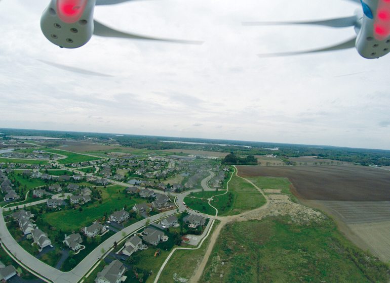
Drones bring a technological and cost advantage to doing volumetric surveys, Chapman said, adding that a drone can quickly and cost effectively collect data to create a survey grade estimate of how much material is at a particular site. That means anywhere there are piles of material or product, including quarries, metal scrap yards or a construction site, the drone can give an accurate picture of how much needs to be moved.
R.A. Smith also uses drones for developing topographical maps of job sites. He said it works well in areas with limited vegetation, but the camera technology has trouble in areas with a lot of trees.
Chapman said there are some uses for drones when it comes to inspections for the company’s structural engineering division. While the drone doesn’t replace an inspector physically inspecting a bridge or other structure, it can be used to provide an overview and allow the inspector to find out which areas to focus on.
“It has been a great supplement,” Chapman said, adding that there was some fear in the industry that drones would cost people their jobs. He said there are certainly situations where drones can make a process faster or safer, but the big employment disruption hasn’t happened.
Drones have changed the landscape in a different way, though. Chapman said larger companies are increasingly finding themselves in competition with smaller firms for jobs that previously would have taken the staff of a large company.
“That is a reality in our business right now,” he said. “We literally compete with them on projects.”
Both Chapman and Eric Orthey, an innovation consultant at American Family Insurance in Madison, said their companies are largely still in a research and development mode when it comes to drones.
“The use of UAS provides us with a better picture of what our customers are facing in times of need,” said Orthey, adding that the regulations prevent the company from taking full advantage of drones.
But Orthey also said if the regulations were suddenly lifted, there would still be challenges to widespread use throughout the company. One of the issues would be who controls the drone. If there weren’t a requirement to use a licensed pilot, the company would likely train adjustors to operate them.
Orthey also said there is some work to be done on the batteries used for drones. Right now, flights are often limited to 20 or 25 minutes, which doesn’t always leave time to accomplish everything needed for a claim.
The idea for insurance companies is to use drones to get access to damaged areas faster after a catastrophe in a safer way. Orthey said there is a negative connotation around drones in the industry. While the idea of an insurance company with the ability to easily get a view of a customer’s home may be concerning for some, Orthey said American Family is focused on providing benefits.
“We’re not utilizing this to create more concerns for our customers; we want to help them,” he said.
American Family has used drones to inspect homes in rural areas after a claim. Orthey said the company asks the homeowner for permission to bring the drone if the home is in a safe location, adding that it gives American Family a chance to talk about its efforts to use the technology.
“As long as there’s the transparency, people were less concerned about it,” he said.
A December poll by Saint Leo University in Florida found nearly 75 percent of respondents nationally had concerns about the increasing number of drones in the airspace. Among those with concerns, almost two-thirds said personal privacy was an issue for them. A similar percentage said they wouldn’t want their neighbor to have a drone, according to a January 2015 Reuters/Ipsos poll.
State regulation and privacy
While handling air safety falls within the FAA’s purview, the privacy portion of regulation is left to state and local municipalities. A Wisconsin law enacted in 2014 prohibits using a drone to photograph a person where he or she “has a reasonable expectation privacy.”
“If somebody isn’t breaking the law, then drones aren’t any more invasive than satellite technology,” said state Rep. Adam Neylon (R-Pewaukee).
Neylon has been pushing his fellow lawmakers to take a wait-and-see approach to regulating drones, hoping it will help commercial uses develop.
“The general attitude (among lawmakers) is very fearful and cautious of the technology,” Neylon said, adding that many regulators view drones more as a hobby than as something with the potential to change the way business is done.
Neylon said there is something to be said for having smart regulations, but added the United States is being passed by other countries when it comes to commercial drone uses. He recalled being in Turkey for a legislative cultural exchange last summer. While on a hot air balloon trip, someone flew a drone alongside to take a picture of the experience. The photo was available for purchase when he landed.
“That would have been illegal to do that in the United States,” Neylon said.
He said many people view drones as something used for spying on people or as a weapon, not as a tool for inspecting a roof without going on a ladder, or for checking crops, or for helping utility companies do their work.
“It doesn’t really matter if people are ready, because they’re already here,” Neylon said.
Drone entrepreneurs
Cousins Mitchell and Zach Fiene are among those making a go of it as drone entrepreneurs. The duo spent summers in college scouting crops for farmers. Days spent walking through fields, almost at random, looking for signs of plant diseases or checking nutrients led them to an idea.
“We were thinking, ‘there has to be a better way of doing this,’” Zach Fiene said.

Now, as co-founders of DMZ Aerial, they offer drone services to agriculture clients throughout the country.
The services include straightforward aerial photography of crops, allowing farmers to look for discoloration in their fields. DMZ also can program the drone to take a picture at set intervals and then stitch the pictures together, creating something like a super high-resolution Google Earth image. The technique can be used in insurance situations, allowing for accurate measurement of how much of a field was damaged.
The Fienes also use the combination of two photos—one with traditional light and the other with near infrared light—to measure how much stress plants are under.
They’ve also expanded their business into helping others navigate the regulatory landscape established by the FAA.
“The biggest challenge has been the regulatory environment,” Fiene said.
It was the potential regulations that initially delayed Peter Menet’s entry into the drone industry.

Menet, who spent 19 years in the Wisconsin National Guard, including 12 years as a pilot, was working at his brother-in-law’s web development company in 2012 after returning from a deployment. A client saw the toy drones they had in the office and asked them to produce a video for a website.
Menet started looking into the regulations, but ultimately told the client he couldn’t do it. As a commercial pilot, Menet didn’t feel he could really claim ignorance of the regulations. While he said the FAA has acknowledged it can’t chase every reported drone sighting and issue fines, the concern was really what would happen if something went wrong.
Now, Menet has built a business with two full-time employees and six contract workers, all to offer drone services.
Some of the uses include working with the geographic information system many municipalities have in place. The drones allow for reduced costs, regular flights and better resolution.
Menet said drones can also offer a birds-eye view of a construction project instead of spending hours walking a building. A 3D model of the project’s progress, produced from the flight, can be compared to the plans to check if footings, plumbing or walls are in the right place.
“It really is a very revolutionary technology if you know how to leverage it and understand its limitations,” he said.
The path forward
Klingaman said the line of sight requirement—which he called the biggest limitation to business uses—is “a very difficult challenge” for regulators, manufacturers, law enforcement, users and the general community to move beyond. He said he expects the FAA to implement tiers of regulations. One set would address close proximity uses and the other would allow drones to fly longer distances.
“The fix is technological and it’s not cheap,” he said, adding it will likely involve something that allows the devices to communicate with each other and with other aircraft nearby. Airplanes are moving toward similar technology and the cost can be as high as $10,000, he said.
Going beyond line of sight will require optics like autonomous cars, increased processing power and better batteries.
“I still don’t know how you’re going to keep them out of trees,” he said, adding those are just some of the challenges preventing Amazon from having drones flying in and out of its Kenosha distribution facility “like a beehive.”
Drone facts and figures:
1,346
pilot reports of drones in close proximity to their flight path between November 2014 and Jan. 31, 2016 (including 9 in Wisconsin)
Source: FAA
$300 to $1,400
Cost of DJI Phantom series drone
Source: DJI.com
$82 billion
projected economic impact of drones in U.S.
$527 million
projected economic impact of drones in Wisconsin
Source: Association of Unmanned Vehicle Systems International
35.1%
respondents very or somewhat interested in owning a drone
Among the 35.1 percent, the reasons for wanting a drone were:
- 7 percent – to see own property from heights
- 2 percent – a fun hobby, a more advanced model plane
- 7 percent – to observe my neighbors
- 3 percent – safety/security interests
- 1 percent – other
Source: Saint Leo University Polling Institute, December 2015
Get the day’s top headlines delivered to your inbox, Monday through Friday. Sign up for the BizTimes Daily at biztimes.com/subscribe.